
Ocean interfaces under global changes –
Exploring the fate of the Amazon River plume
06.05.2021 – Using satellites to map the Amazon River Outflow and plan our sampling locations
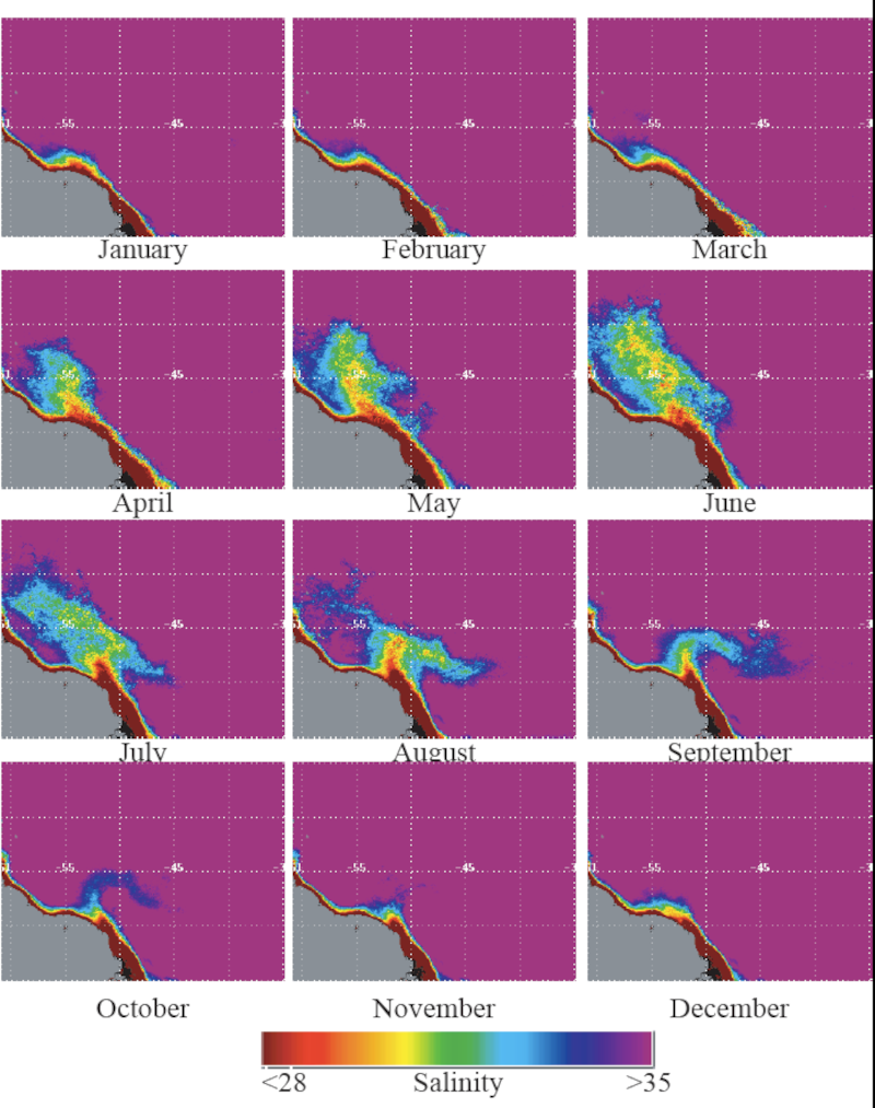
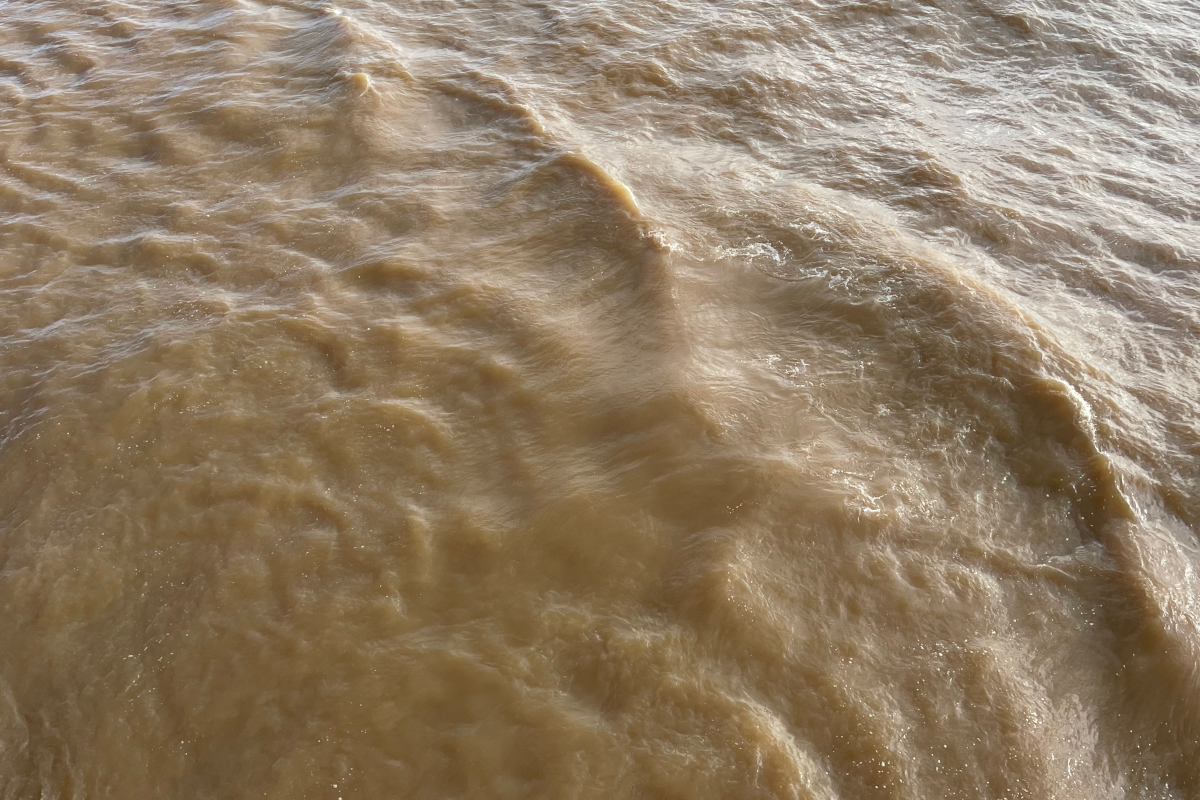
The Amazon River, the greatest river in the world, is 16 times larger than the next largest river or larger than the next seven largest rivers combined and provides almost 20% of all the freshwater flowing from land into the ocean. The Amazon delta straddles the equator and the freshwater exiting the mouth of the river is initially carried northwestward along the coast of Brazil by the North Brazil Current. The volume of freshwater is so immense, at over 200 million liters per second, that we observed pure freshwater with no ocean influence more than 100km from land. At about 7°N, about 750 km from the mouth, the river outflow separates from the coast and flows northward between April and July and is drawn eastward by the seasonal North Equatorial Counter Current between July and November. These strong ocean currents also cause the river outflow to break up into smaller patches and filaments as the freshwater mixes with the ocean water. The freshwater influence of the river outflow can be observed over 2000km from the mouth and can cover an area greater than 1 million square kilometers for a few months of the year during its highest flow. For context, this is more than three times the area of the entire country of Germany.
Given how vast and dynamic the river outflow is, it is very challenging to study the entire system using just conventional ship-based observations. It is literally as though the water you are studying changes even as you are studying it. Space-based satellites, on the other hand, are ideal tools for observing such vast and quickly changing surface phenomena. For example, some satellites go around the earth every 96 minutes and cover the entire globe every day. It is estimated that it would take 11 years for a ship steaming nonstop at 10knots (18km/h, the typical speed of most research vessels) to sample the region covered by a two-minute satellite image. Thus satellites can provide us instantaneous snapshots of the ocean surface, something that is especially important to study the very dynamic features of the Amazon River outflow.
Ocean color satellites have sensors that measure the color of the water from which we can deduce the amount of various materials in the water. The Amazon River carries a high load of sediments and dissolved organic matter from the rainforests, giving the river a bright brown muddy color at the mouth of the river. But as the outflow moves north, the sediments settle out from the surface and the color of water turns a dark green due to the combination of dissolved organic matter as well as the presence of phytoplankton – the single-cell plants that grown in water and here are nourished by the nutrients provided by the river outflow. Phytoplankton has chlorophyll, the same pigment that is found in leaves on trees and gives them a green color.
We use this information on the color of the water to trace the river outflow from satellites.
The daily maps provided by satellites along with information we have gathered on previous surveys of the region helps us decide where to go with the ship next and the conditions in the water we can anticipate seeing when we get there. Our daily sampling plans are thus guided from space and ensure a good coverage of the plume along its way from the river mouth into the open ocean.
Text: Subramaniam A., Voss M., Choisnard N., (all IOW) | click pictures to enlarge
| Expedition: | M174 |
| Mission: | MeNARP |
| Start: | 12.04.2021 - Las Palmas |
| Destination: | 31.05.2021 - Emden |
|
|
|
|