
RANGS
RANGS ist die Abkürzung von “Regionally Accessible Nested Global Shorelines”.
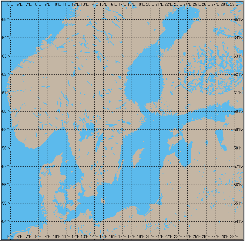
In digitaler Form sind geschlossene Polygone für die Küstenlinien innerhalb jeder 1° x 1° Gitterzelle der Erdoberfläche verfügbar. Sie sind in 4 Ebenen ineinander eingebettet, Land im Ozean, Seen an Land, Inseln in Seen und Teiche auf Inseln. Sie liegen in 5 Auflösungen vor, die höchste davon mit etwa 100 m. Einzelheiten sind veröffentlicht in dem Artikel
Feistel, R.: New Shoreline Map-Drawing Data Available. Eos, June 1, 1999, Vol. 80, No.22, Page 249. Eos, Transactions, American Geophysical Union, Electronic Supplement, June 7, 1999, available at http://earth.agu.org/eos_elec/99063e.html
| RANGS - Regionally Accessible Nested Global Shorelines |
|||
|---|---|---|---|
| A binary file set RANGS (Regionally Accessible Nested Global Shorelines)
based on GSHHS (Global Self-consistent Hierarchical High-resolution Shorelines) data.
Regional access speeds up drawing of world-wide high resolution polygons,
nested structures are required for land masking or rendering with tools like OpenGL .
GSHHS is a modified PC version of the files computed by Wessel & Smith .
GSHHS is self-consistent and can be used for drawing shorelines on its own.
RANGS is an access directory to GSHHS and can only be used together with GSHHS.
GSHHS and RANGS are available at different resolution levels. RANGS has been published in EOS, the Newspaper of the AGU, June 7, 1999. |
|||
| RANGS.pdf | 135kB | Details | |
| RANGS.frm | 4kB | For using RANGS, here is an example program in Visual Basic | |
| FILL.frm | 11kB | Still in VB, but using Win APIs to be faster and capable of filling | |
| MAPPER.zip | 87MB | A Java Demo program has been written by David Mikesell (University of Virginia) (incl. GSHHS/RANGS files, from University of Virginia) |
|
| MAPPER.zip | 87MB | incl. GSHHS/RANGS files, from IOW-Mirror | |
| MAPPER0.zip | 29kB | without GSHHS/RANGS files, from IOW-Server | |
| Resolution | Download RANGS |
Download GSHHS |
|---|---|---|
| < 100m |
rangs(0).zip [2.4MB] |
gshhs(0).zip [59.8MB] |
| 200m | rangs(1).zip [2.1MB] | gshhs(1).zip [14.7MB] |
| 1km | rangs(2).zip [1.3MB] | gshhs(2).zip [3.7MB] |
| 5km | rangs(3).zip [0.8MB] | gshhs(3).zip [0.8MB] |
| 25km | rangs(4).zip [0.7MB] | gshhs(4).zip [0.1MB] |