
The Benguela System under climate change - Effects of Variability in physical forcing on carbon and oxygen budgets
21.01.-22.01.2022 Different water masses meet off Namibia
We have now reached the northernmost transect of our sampling area. In addition to work on determining the diversity of the bottom-dwelling fauna, we are also carrying out oceanographically focused analyses of the water masses.
Why is that?
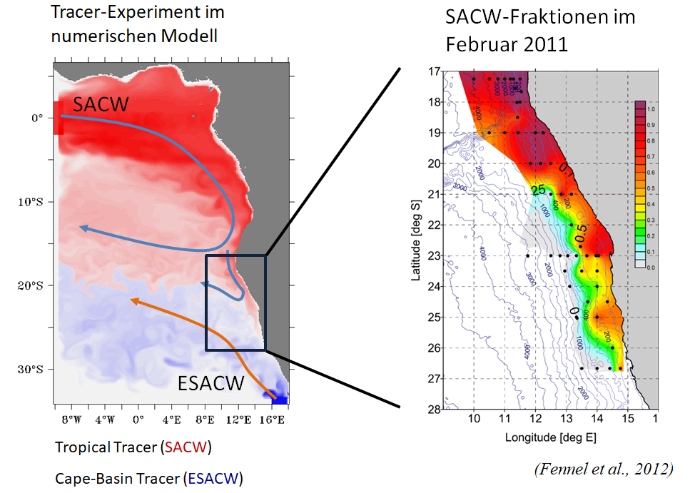
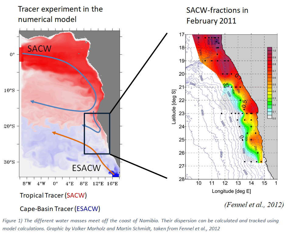
In the Benguela upwelling area, water masses of different origins meet or mix. These include the south atlantic central water (SACW) coming from the north and originating south of the equator, and the eastern south atlantic central water (ESACW) coming from the south. Both water masses differ in their physical properties: temperature and salinity. Further differences can also be found in the nutrient and oxygen conditions. The ESACW, which comes from the south, is significantly richer in oxygen but poorer in nutrients. The SACW from the north, on the other hand, is rich in nutrients but poor in oxygen. In previous work, our cruise leader Dr. Volker Mohrholz, in collaboration with Dr. Martin Schmidt from the working group “Physical-biogeochemical coupling of marine systems”, was able to show that the proportion of both water masses in a water sample can be calculated using a simple mixing model based on salinity and temperature. Thus, with each CTD deployment, and the accompanying measurements of temperature and salinity, we obtain information about the composition of our water sample from the two water masses. However, the composition of the two water masses may change over time. To find out, we are also sampling ocean areas on this cruise where predominantly only one of the two water masses occurs. For the SACW this applies to 18°S latitude, for the ESACW however to 27°S latitude. Only if the properties of both sources are sufficiently known can mixing ratios be reliably calculated.
However, the oceanographers among us are not only interested in the origin of the sampled water, but above all in the flow dynamics in the upwelling region and how these are changing in the course of climate change and the associated global warming.
Various devices are used to get to the bottom of this. These include the so-called ScanFish and the microstructure probe (MSS for short). Both measuring devices are similar to the normal CTD, which we have already explained, and are equipped with sensors to determine temperature, salinity and oxygen, but differ in their resolution. While the sensors of the CTD and the ScanFish take 24 measurements per second, the MSS takes 1000 measurements per second. The ScanFish is a device that is attached to the stern, lowered into the water and then towed behind the ship. In the process, the ScanFish moves back and forth within the upper 140 m of water depth, alternating between the seabed and the surface. This provides a two-dimensional profile of oxygen, temperature, salinity and other parameters along a horizontal gradient. This knowledge is particularly helpful in selecting stations that are of greater interest and should therefore be sampled intensively. In our case, these are those with low to anoxic oxygen conditions. In addition to the sensors already mentioned, the MSS is also equipped with two shear sensors that can be used to measure turbulence in the water column, allowing profiles of water flow velocities and directions to be mapped down to a depth of 500 meters.
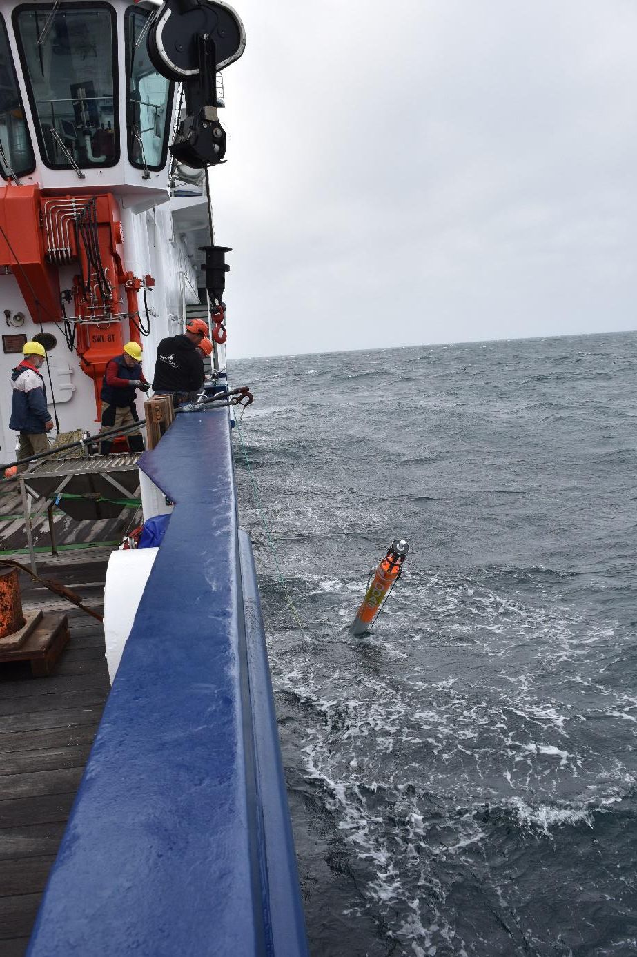
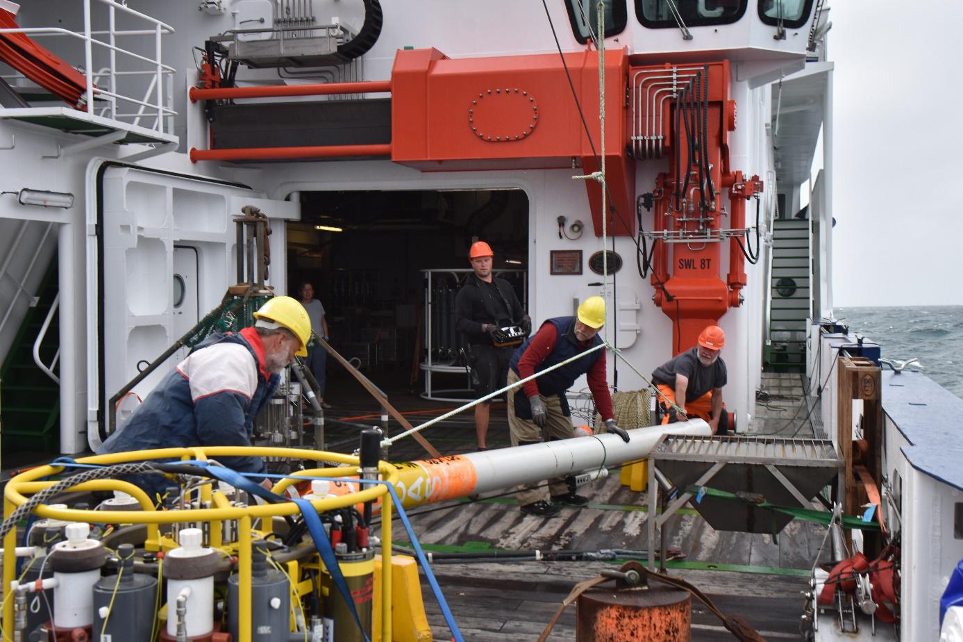
In addition, a drift body was launched at various points in the upwelling area during our trip and its transport path was tracked with the water current by GPS. This gives us further information about the flow paths of the different water masses. In addition, there is a rope attached to the drifter, to which temperature sensors are attached at defined intervals. When the drifter is lowered into the water, the measurements of the different temperature probes result in a vertical temperature profile that extends over a distance of 40 m, from which in turn information about the temporal dynamics in the stratification of the upper water body can be derived.
Text: Fabian J., Braun P. (both IOW)
| Expedition: | MSM105 |
| Mission: | BUSUC 2 |
| Start: | 11.01.2022 - Walvis Bay |
| Ziel: | 23.03.2022 - Mindelo |
|
|
|
|
|
|
|