Joanna J. Waniek - Projects
NAPOLY
In the proposed project, we aim to investigate microplastic abundance in the deep North Atlantic using sediment trap time series along three hypotheses H1) Regional differences are caused by differences in dominating transport pathways and polymer compositions within the microplastic fluxes. H2) A gradient of microplastic flux rates exist from south to the north with increasing microplastic fluxes in more northern locations because of higher biological production rates and H3) The similar transport mechanisms for POPs and plastics from the atmosphere to the deep ocean are evidenced by a positive correlation of POPs and microplastic abundances in sediment trap samples. We are aiming at evaluating microplastic abundances and its polymer composition in sediment trap samples in terms of seasonal, annual, and regional patterns (H1) using sediment trap samples from different sampling sites L1 (Kiel276), L2, L3, BATS, and NB. This will reveal seasonal and annual patterns as well as in addition to the temporal resolution, provide spatial microplastic distributions within the 2000 m depth of North Atlantic Ocean. As microplastic is strongly suspected of acting as a vector for toxic substances, transporting high concentrations of POPs across the oceans, the evaluation of microplastic and POP fluxes in the deep Atlantic Ocean offers a valuable opportunity to elucidate this property for the deep sea. Due to the high number of potential POP substances potentially detectable in sinking material were chosen, still present in environmental samples, such as polycyclic aromatic hydrocarbons (PAHs), chlorinated diphenyl’s (PCBs), and Dichlorodiphenyltrichloroethane (DDT). This is DFG funded project WA2157/12-1, 6/2024-05/2027.
E-POLIO
The EPOLIO project uses the expedition along the transect between Singapore and Port Louis to measure a range of pollutants in the air, surface waters and water column of the Indian Ocean to quantify anthropogenic stress and to provide a first risk assessment in the region. Furthermore, it is planned to identify the water masses their sources and element cycling processes in this understudied region. The study area represents an ideal model system as it crosses almost the entire Indian Ocean basin, starting from the highly populated regions of Indonesia, Malaysia and Singapore and extending into the open Indian Ocean. The expedition allows better understanding of the impact of megacities on the land-coast-ocean interaction and beyond, in a very sensitive and understudied marine ecosystem. In particular we are aiming (1) to map the concentrations of pollutants (e.g. estrogens) and abundance of microplastic in relation to hydrographic conditions in surface waters and vertically in water masses at selected positions; (2) to identify anthropogenic pollutants transport pathways horizontally, from land to the open ocean, and vertically, from the water surface to deeper water layers, their sources and possible sinks into Indian Ocean; (3) to assess and quantify the anthropogenic contamination with emerging pollutants (microplastic, oestrogens) by using environmental descriptors e.g. risk quotient (RQ) or estradiol equivalent concentration (EEQ) as well as (4) to understand water mass distribution and nitrogen cycling in the central equatorial and southern Indian Ocean, one of the least studied oceanic areas worldwide. The cruise is endorsed Ocean Decade activity. The project is funded by BMBF under the contract number (FKZ 03G0305TA) until 7/2026.
SOCLIS
The joint project South China Sea-natural laboratory under climatic and human induced stress (SOCLIS) aims to study the marine environmental conditions in an area spanning from the northern shelf of the South China Sea towards the deep sea, to enhance our understanding of the effects of growing anthropogenic pressure in a highly dynamic marine ecosystem governed by natural variability ranging on space scales from small to mesoscale and time scales from daily to decadal. Our study area is an excellent example of a subtropical adjacent sea and a natural laboratory to study the exchange processes between the land and the ocean (Pearl River), the variability of physical forcing (monsoon, circulation), the drastically increasing anthropogenic stress (nutrients/eutrophication, organic contaminants, microplastics, antibiotics) following the development of a Megacity around the Pearl river estuary within the area Guangzhou-Hong Kong. The joint project extends the MEGAPOL activities into the year 2021. Its major activity is the cruise SO269 with the German research vessel SONNE starting in August from Singapore.SOCLIS is coordinated by IOW, with partners at University Hamburg, here the Institute for Geology, the Helmholtz-Zentrum Geesthacht and partners in China with Shanghai Jiao Tong University and the Guangzhou Marine Geological Survey. The 30 month long project is funded by BMBF under the contract number (FKZ 03G0269).
TRAN
Within TRAN (Temporal pattern of anthropogenic and natural particles at the slope of South China Sea) a contamination free mooring will be deployed at the nothern continental slope of South China Sea in the area affected by the Pearl River plume. The mooring will allow to register the temporal pattern of sedimentation of natural and anthopogenic particles, and is set up as extension to the bilateral Sino-German MEGAPOL project. The IOW project Megacity’s fingerprint in Chinese southern marginal seas: Investigation of pollutant fingerprints and dispersal aims to study the marine environmental conditions in an area spanning from the northern shelf in proximity to Pearl River of the South China Sea towards the deep sea, to enhance our understanding of the effects of growing anthropogenic pressure in a highly dynamic marine ecosystem governed by natural variability ranging on space scales from small to mesoscale and time from daily to decadal. Duration 01.10.2017-31.01.2018, FKZ 01DO17038.
MEGAPOL
The consortium Megacity’s fingerprint in Chinese marginal seas: Investigation of pollutant fingerprints and dispersal is divided into two projects with different regional focus. The IOW project Megacity’s fingerprint in Chinese southern marginal seas: Investigation of pollutant fingerprints and dispersal aims to study the marine environmental conditions in an area spanning from the northern shelf in proximity to Pearl River of the South China Sea towards the deep sea, to enhance our understanding of the effects of growing anthropogenic pressure in a highly dynamic marine ecosystem governed by natural variability ranging on space scales from small to mesoscale and time from daily to decadal. The area is an excellent natural laboratory to study the exchange processes between the land and the ocean (Pearl River), the variability of physical forcing (monsoon, circulation), the drastically increasing anthropogenic stress (nutrients/eutrophication, organic contaminants, microplastic, antibiotics) following the development of a Megacity within the area Guangzhou-Hong Kong. We are aiming to improving our understanding of the complex interactions between land, the coastal ocean and the open ocean and their resulting alterations due to effects of climate variability and anthropogenic stressors in a highly sensitive ecosystem. Our results will help to quantify the marine N, P, C cycles, allow the quantification and distribution of anthropogenic contamination as well as the degree of time-space variability of natural oceanic processes. This consortiums with 4 German and 5 Chinese partners work is closely linked to the complementary twin project Megacity’s fingerprint in Chinese eastern marginal seas: Investigation of pollutant fingerprints and dispersal regionally focussed on Bohai Sea, Yellow Sea and the Yangtse River. Samples will be gained and exchanged between the twin projects aiming at an overview of the regional distribution of several substances within the partitions water, suspended matter and sediment. Intercalibration exercises regarding UV-filters and joint modelling efforts are part of the activities, going hand in hand with joint meetings, cruises and publications for participants of both consortia. Our consortium project contributes to the BMBF program marine research (Meeresforschung, PTJ) and is rooted in the WTZ-China initiative, dating back to 1986. Our activities are a continuation of the bilateral projects PECAI and BEIBU, both relevant to the programs Forschung für die Nachhaltigkeit (FONA) and System Erde. The consortium is funded by BMBF under contrct 03F0786A (01.08.2017-31.07.2020).
MikrOMIK
Microplastic has become one of the most freuquent polutants in the marine environment over the last century.The joint project MikrOMIK fundet by the Leibniz Association is aiming at a comprehensive analysis of microplastic regionally focussing on the Baltic Sea, and thematically focusing on the microbial populations colonizing the plastic particles. So far, only rough estimations of the abundance and distribution of microplastic in the Baltic Sea exist, and nothing is known about the interaction between microplastic and microorganisms in this ecosystem. Even less is know about the behaviour of microplastic regarding sinkingvelocities, distribution pattern and its sources and sinks.
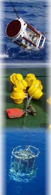
SMIS
The joint projeckt Subsea Monitoring via Intelligent Swarms is aiming on developing a fleet of vehicles for efficient and intelligent monitoring of big areals of the marine environment. The underwater vehicles will be able to cope with depths up to 6000 m. The trials in the Baltic Sea and the first deployments of the vehicles will take place in the Northeast atlantic in the vicinity of the Kiel276 mooring, within the Madeira Basin with depth up to 5300 m. Kiel276 (33°N, 22°W), in the eastern part of the North Atlantic Subtropical Gyre Provinz, is strongly influence by the Azores Front, however despite 30 years of measurements in the region, 3 dimensional information about the front is stil missing. The fleet will help to close the gap and provide temporally insight about the influence of the front on the thermocline dynamics in this part of the Atlantic Ocean. The joint BMWi project runs from 01.01.2013 until 30.06.2016 (TP IOW 03SX348F).
Decade
The time series from Kiel276 station at 33°N, 22°W, span from 1980 to presence, are unique world wide. In the framework of the project we will use the in-situ data from Kiel276 to investigate decadal and inter-decadal changes in the physical and biogeochemical properties and place the results into context of climate variability. The project is funded by DFG (WA2175/5-1) and runs from 7/2011 to 6/2014.
Beibu
The aim of the project is a budget of meso- to longterm energie and matter fluxes in the Beibu Gulf as a function of natural and anthopogenic drivers. The Beibu Gulf is important for the understanding of changes in the recent sedimentation processes and the balance of matter transport from the coastal near regions, surface near degradation of organic matter and the resulting element fluxes. In his holocene sedimentation history the gulf mirrores the interactions between the southern oscillation, climate induce circulation, sediment transport and tectonic processes. Additionally it is strongly influenced by anthropogenic components resulting from the land use in the drainage areas and the coastal zone itself. The sub-projects at IOW carried out intensive studies including hydrography, geology and biogeochemistry, remote sensing and modelling in order to provide a characterisation of the region for the SW monsoon. The biogeochemical investigations in the water column and the sediments provide informations about sources and sinks of organic matter, organic contaminants and selected trace metals. Additionally the ZMT sub-project investigated the inputs of dissolved and particulate organic substanzes and nutrients in the coastal strip of the Guangxi province especially in selected mangroves. The field work took place during two expeditions with Chinese (FENDOU5 in September 2009) and German (SONNE SO219 in December 2011) vessels. The interpretation of all data is joinly carried out by scientists from all involved institutions (BMBF 03F0607A, WTZ China, 07/2009-06/2012).
Madeira
The study area in this project is the Kiel276 station at 33°N, 22°W in the Madeira Baisin in the subtropical northeast Atlantic. The importance of the Azores frontal system for the formation of particle flux, its modifications and transports in the water column was the thematical focuss in this study. The project is funded by DFG (WA2175/1-1).
Lithflux
The Azores Current frontal system forms the nothern border of the anticyclonic gyre in subtropical Northatlantic. It plays an important role reagarding input, transport, modification and sedimentation of biogeochemical particles. The input of lithogenic material and gases, in particular dust from Sahara and carbon over the atmospheric pathway is modified through chemical processes and biological activitity. Those atmospheric inputs, transports and material modifications in the water column are all characterised by seasonal and interannual variability, and according to our knowledge are all influenced by physical and biological processes. This project concentrate regionally on the Kiel276 station at 33°N, 22°W and focusses on the understanding of the temporal variation of lithogenic particle flux and its role in fertilisation of the surface waters in this part of the subtropical Atlantic Ocean. Funded by DFG (WA2175/2-1).
Asymmetrie
Two stations in the subtropical gyre in the Northatlantic are chosen as regional focuss of this proposed project, because of the East-West asymmetry manifested in their hydrographical and biological characteristica. The study focusses on Kiel276 in the Madeira Abyssal Plain in the eastern Northatlantic and the BATS station in the western subtropical gyre. In particular in the framework of this study the following questions are addressed: 1) In which biological and physical parameters is the East-West asymmetry most evident? Which processes are responsible fort he East-West differences between this two stations and provinces (K276 NAST-E & BATS NAST-W)? 2) Are those differences also evident in the particle flux (annual cycle, amount of the sinking material, its composition) at those stations? 3) Does the lithogenic fraction of the particles differ as well in terms of composition? From which source region originate the lithogenic particles at BATS? Funded by DFG (WA2175/3-1).
BaTRE
Estimation of ocean diapycnal mixing and isopycnal spreading in the open ocean, marginal seas and near the ocean bottom boundary layers is often accomplished by purposeful long-lived tracer release. The OTIS (Ocean Tracer Injection System) was succesfully used in summer 2007 in the Baltic Sea, where at a depth of about 200m a small amount of SF5CF3 was released in the Gotland Basin. Since September 2007 the tracer and its distribution is followed. This tracer release will allow for the first time to observe integral diapycnal mixing and lateral dispersion rates. In the chemical part of the project investigations of the particle affinity of the tracer are carried out.